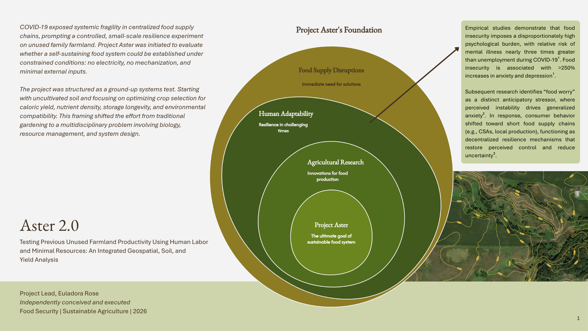
Project Aster is a multi-year experiment exploring whether previously unused farmland
can support meaningful food production with no electricity, no mechanization, and minimal external
inputs.
GPS Coordinates(44.639, -96.341)
LocationTaunton, MN
LandUndeveloped - Marginal
Taunton, MN
Video coming soon
Fieldwork
Project Aster
What began as a question about food security has developed into an investigation combining agriculture, soil
science, geospatial analysis, environmental observation, and system design. Rather than asking only what can
grow, Aster examines how land, labor, water, soil, and crop selection interact when resources are deliberately
constrained.
🔍Project overview — fig. 01
The Record
Two Seasons on the Hillside
🔍
2024 — Aster 1.0
The First Season
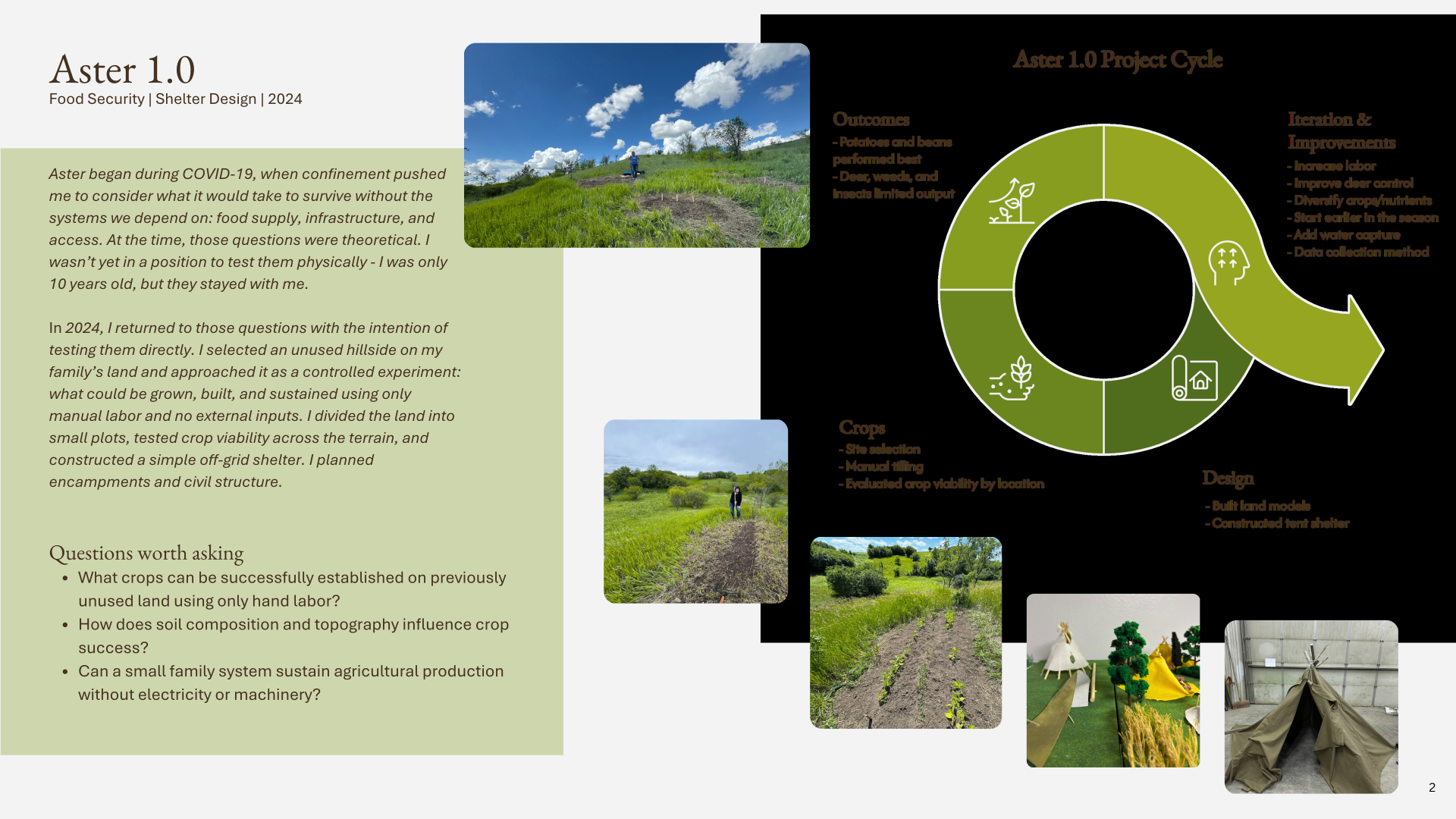
The idea for Aster began during COVID-19, when disruptions to everyday systems made me think more seriously
about how dependent we are on food supply chains, infrastructure, and access. At the time, those questions
were theoretical. I was only ten years old and wasn't yet in a position to test them physically.
In 2024, I returned to those questions on an unused hillside on my family's land. I manually prepared small
plots, tested crops across the terrain, and constructed a simple off-grid shelter. The first growing cycle
exposed problems with deer, weeds, labor, and crop establishment, but those failures ultimately gave me the
information I needed to redesign the experiment.
🔍
2026 — Aster 2.0
A More Structured Experiment
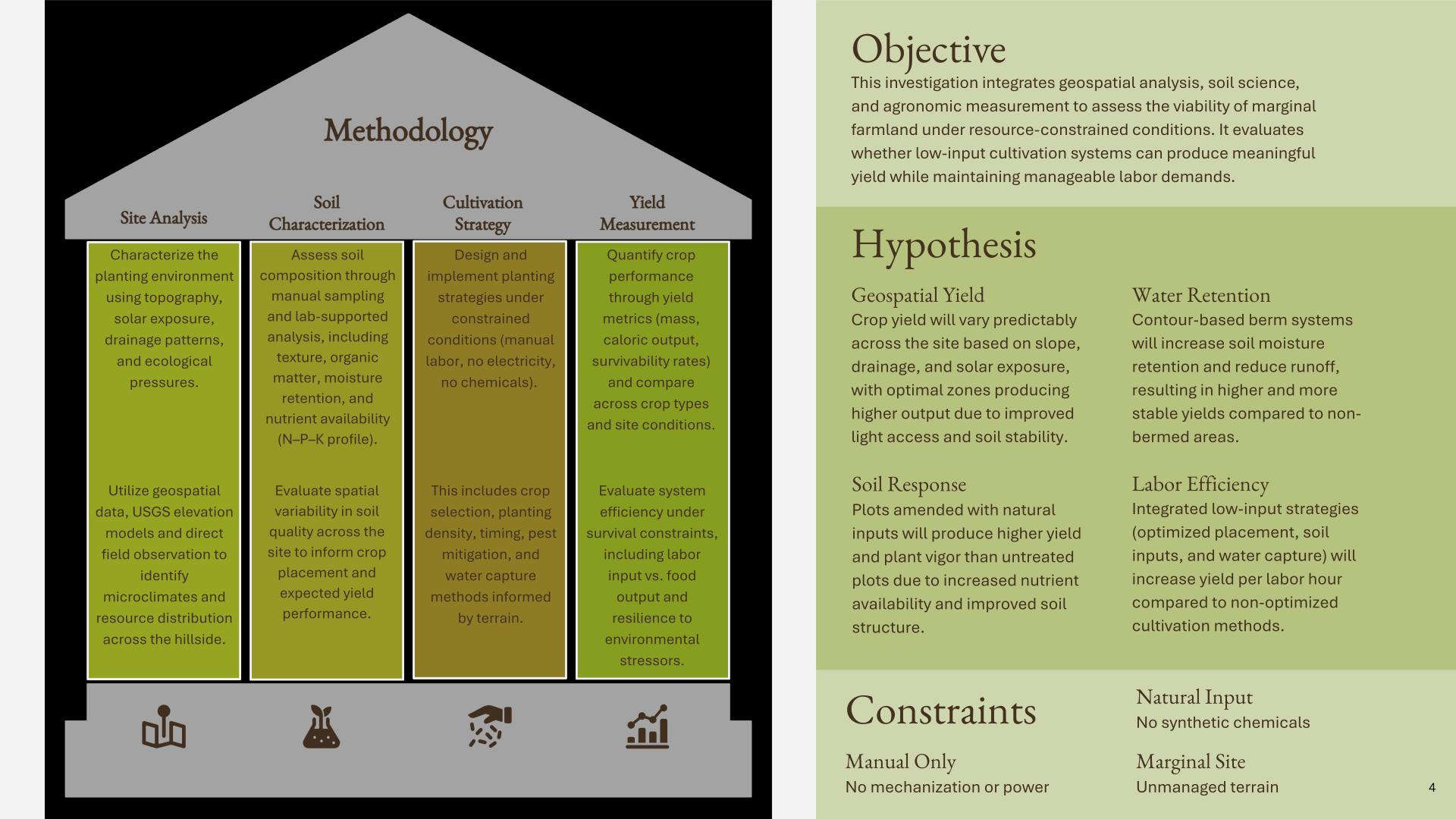
Aster 2.0 turns the observations from 2024 into a more structured field experiment. Instead of simply
trying again, I began separating the system into variables I could study: the characteristics of the site,
differences in soil, crop placement, water retention, external inputs, and human labor.
The 2026 investigation combines geospatial analysis, soil science, cultivation strategy, and yield
measurement to ask a more specific question: how productive can previously unused land become when
cultivation is limited to human labor, natural inputs, and the resources already present within the
landscape?
🔍
Site Analysis
Understanding the Site
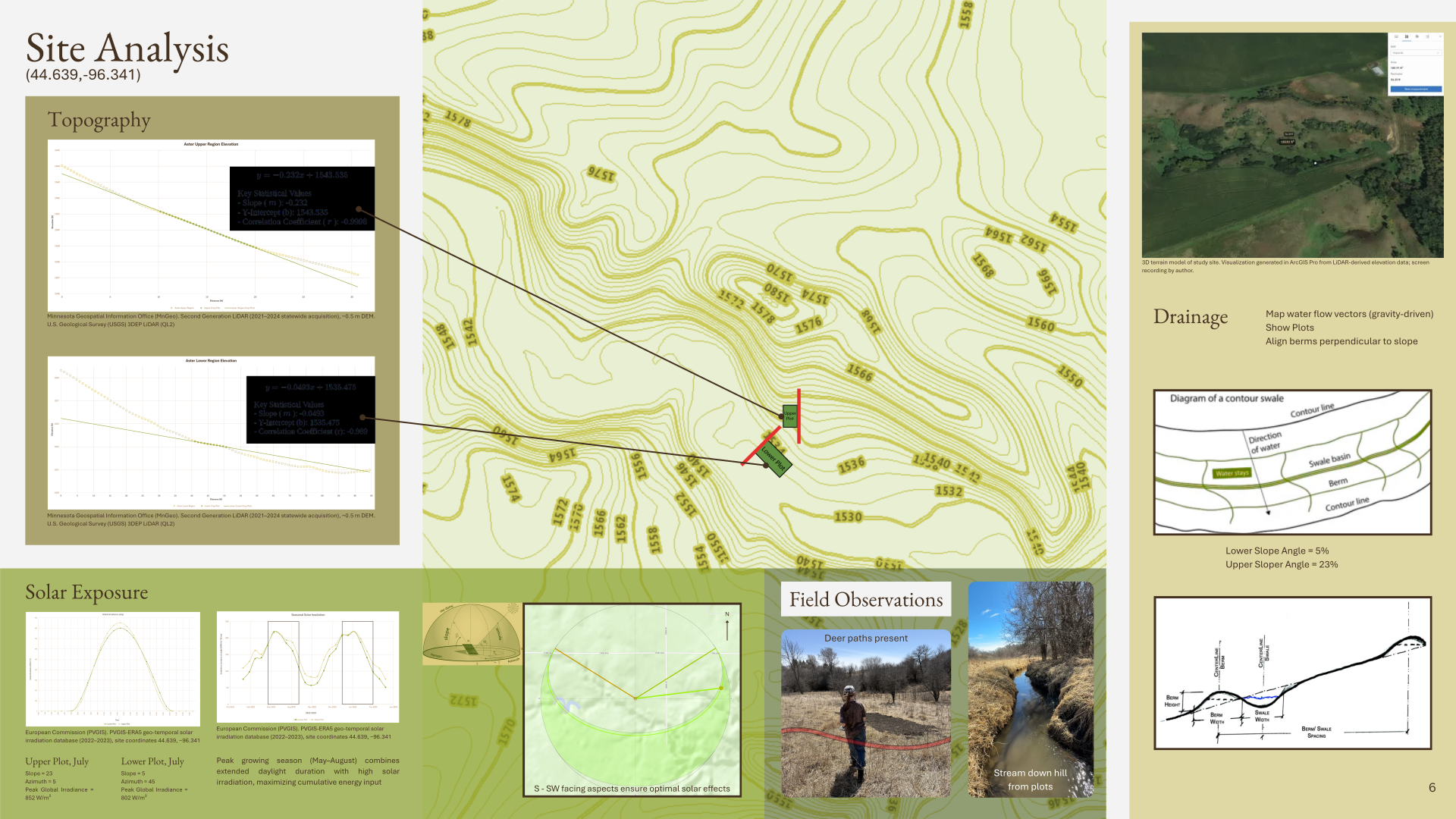
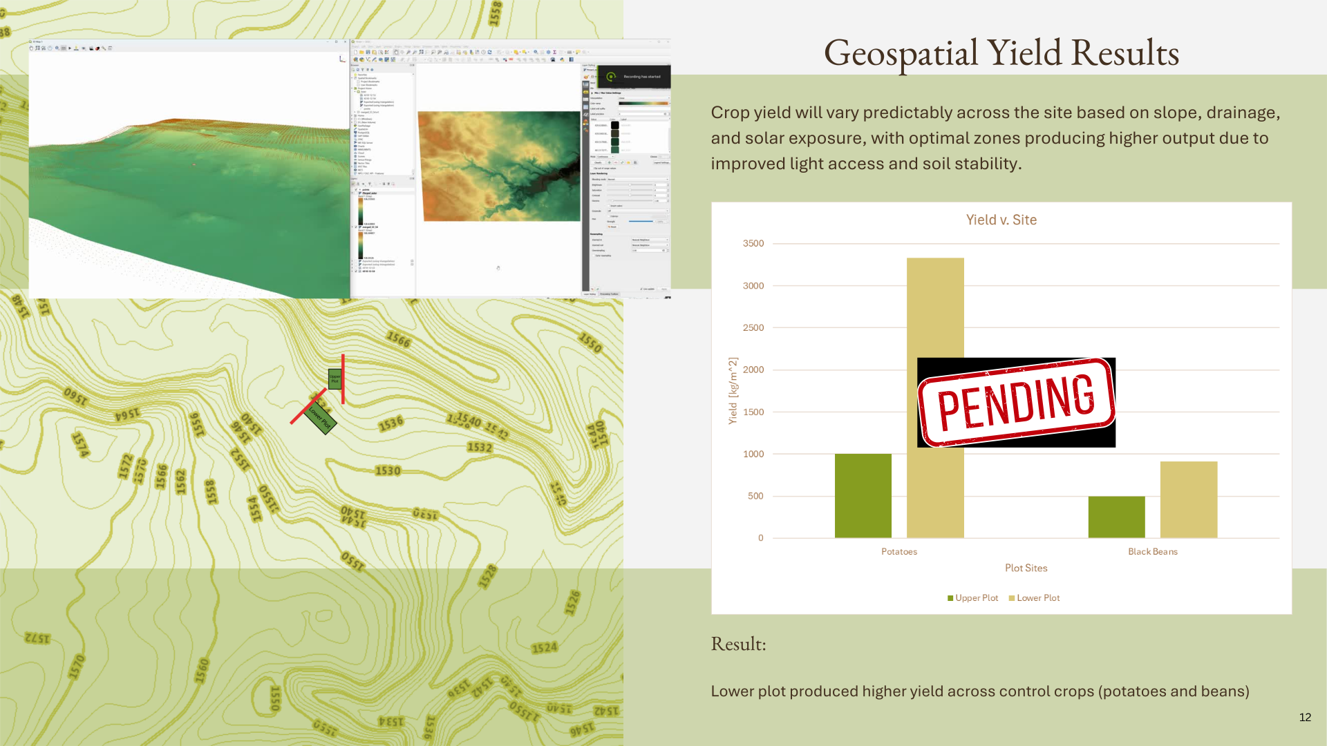
Before deciding what to plant, I needed to understand the hillside itself. I used LiDAR-derived elevation
data, field observations, and solar modeling to study topography, drainage, exposure, and ecological
pressure across the site.
The two primary plots occupy very different terrain. The lower plot has an approximately 5% slope, while
the upper plot reaches approximately 23%. Both receive strong southern to southwestern exposure, but water
movement, wildlife pressure, and soil conditions vary across the hillside. These differences allowed the
landscape itself to become part of the experiment.
🔍
Soil
What Was Happening Below the Surface
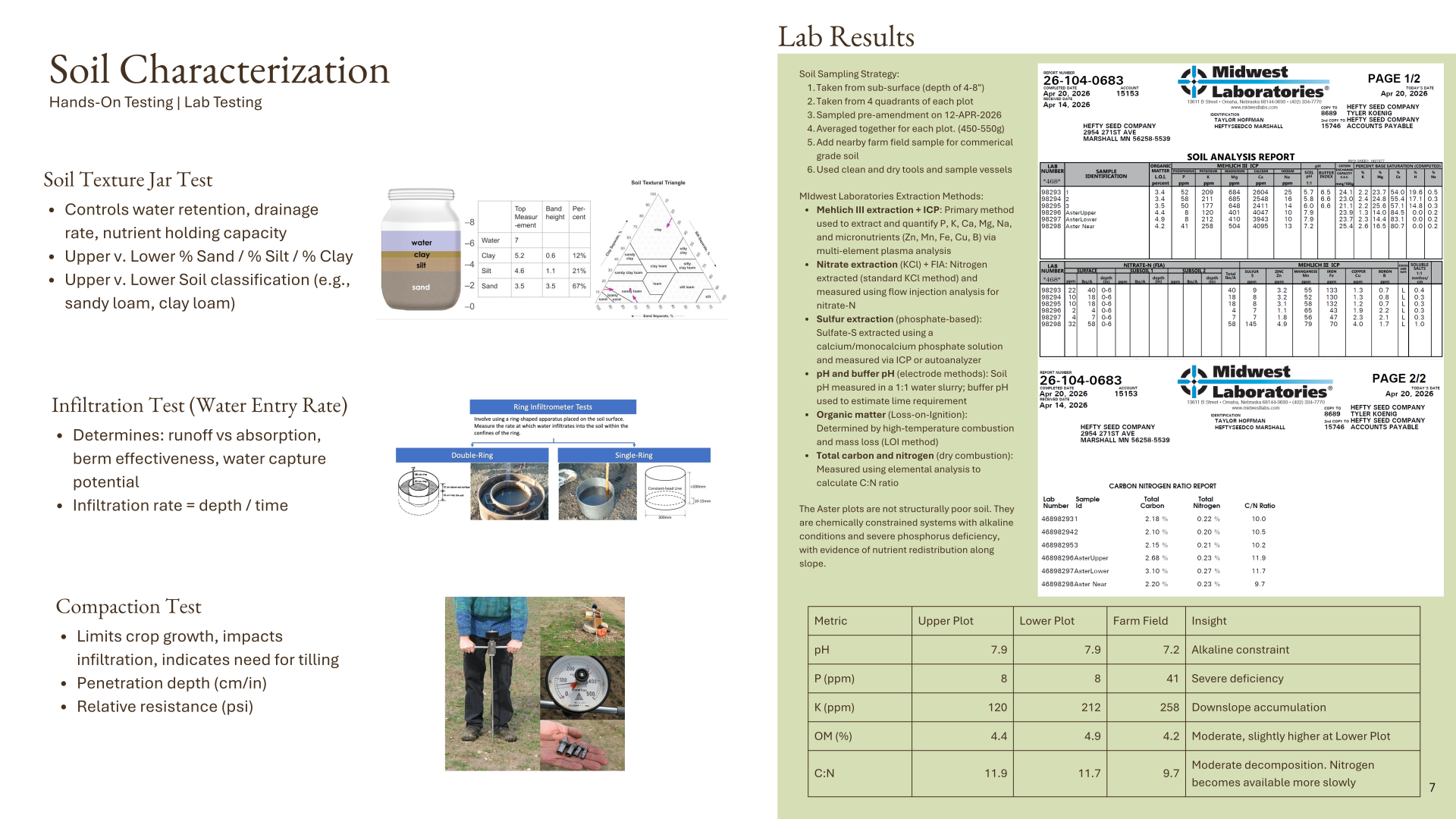
Soil testing revealed that the challenge was more complicated than simply working with previously
uncultivated ground. Both experimental plots had an alkaline pH of 7.9 and phosphorus levels of only 8 ppm,
compared with 41 ppm in a nearby farm-field sample. Potassium also differed substantially between the upper
and lower plots.
The soil was not structurally poor; it was chemically constrained, with severe phosphorus deficiency and
evidence of nutrient redistribution along the slope. These results helped determine crop placement and
provided a baseline for testing different soil treatments.
🔍
Crop Strategy
Choosing What to Grow
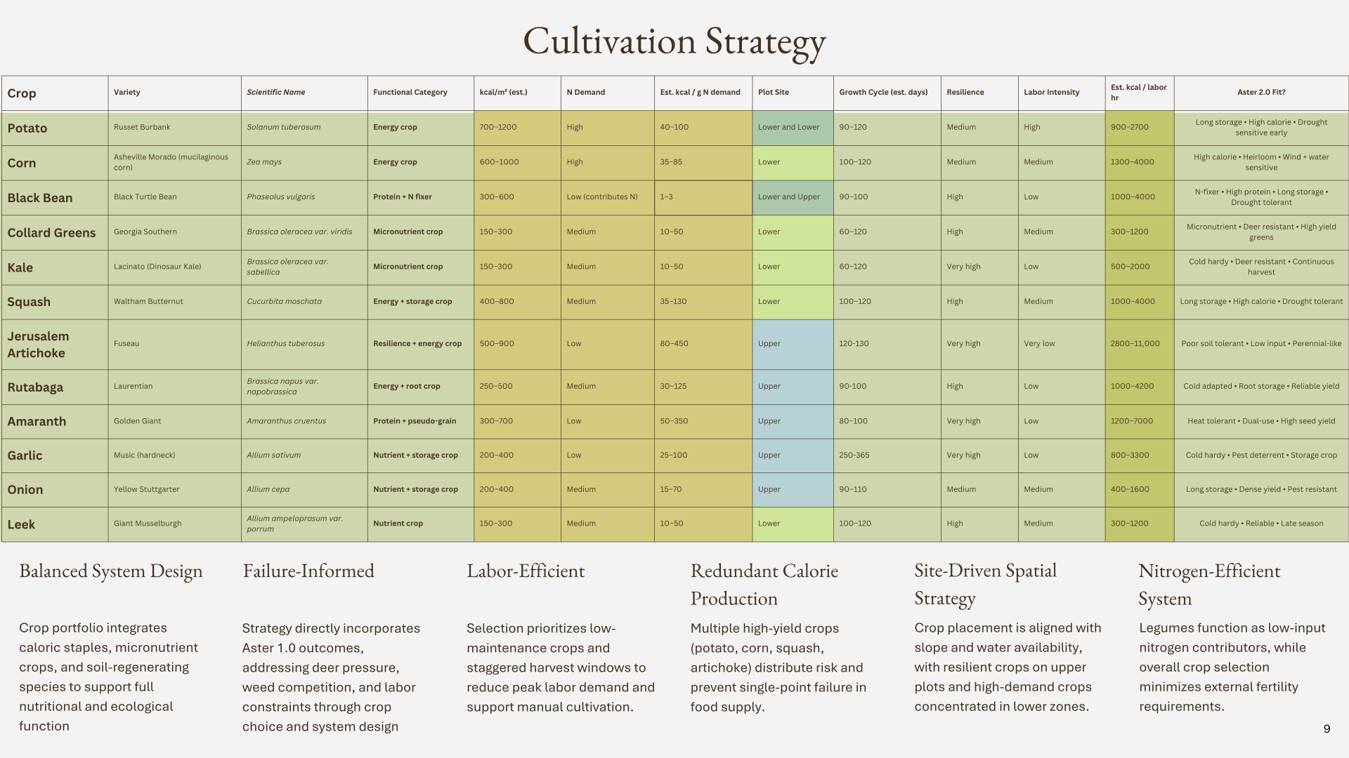
Crop selection became a systems problem of its own. I evaluated potential crops according to caloric
output, nutrition, storage, resilience, nitrogen demand, labor intensity, growth cycle, and compatibility
with different parts of the site.
The final selection combines calorie-producing staples with protein, micronutrient, storage, and resilient
crops. Instead of depending on one high-performing species, the system distributes risk across crops with
different strengths. The goal is not simply maximum yield, but a food system capable of continuing to
produce when individual parts fail.
🔍
Experimental Design
Designing Around the Land
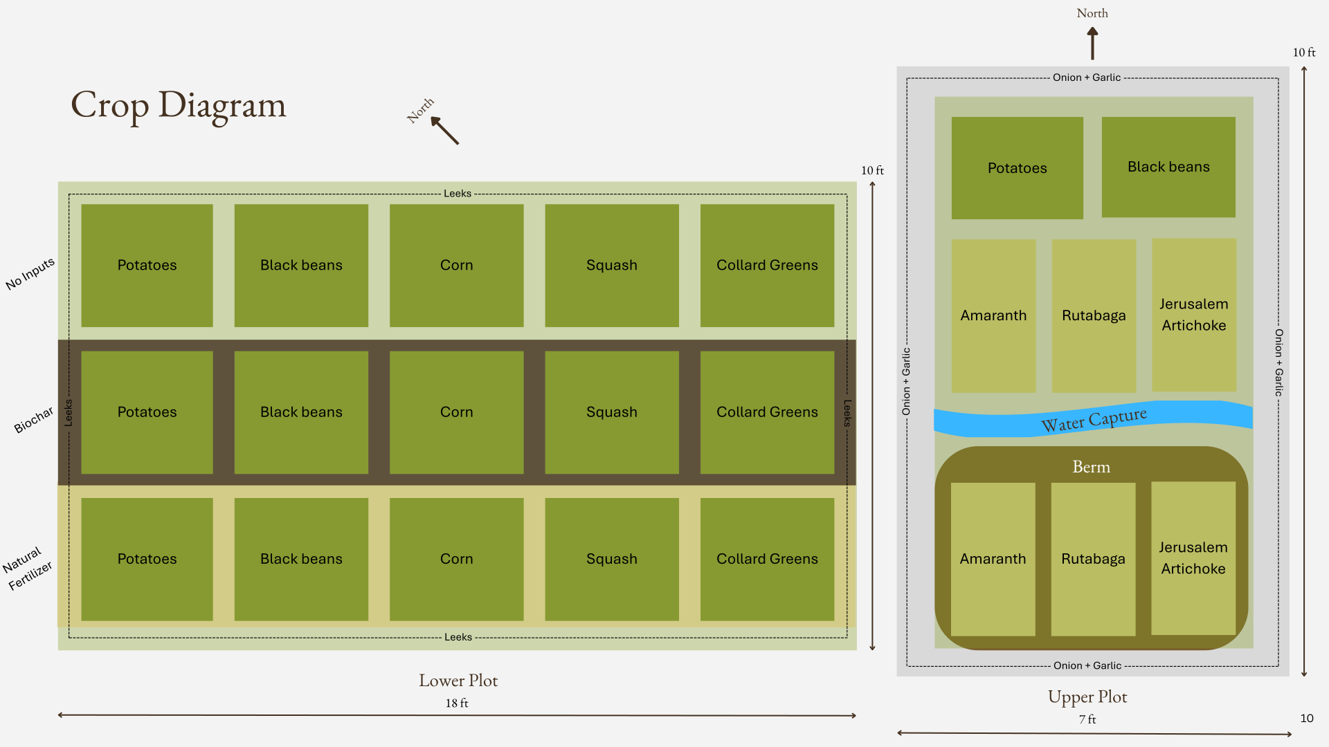
The experimental layout connects crop selection back to the conditions of the hillside. Higher-demand crops
are concentrated primarily in the lower plot, while more resilient crops are tested on the steeper upper
plot.
Within the plots, control areas are compared with natural fertilizer and biochar treatments. Perimeter
planting, fencing, hay mulch, and crop placement also respond directly to problems encountered during Aster
1.0, including deer pressure, weeds, and labor demand. Rather than eliminating every constraint, I am
testing whether the system can be designed around them.
🔍
Water
Working with Water
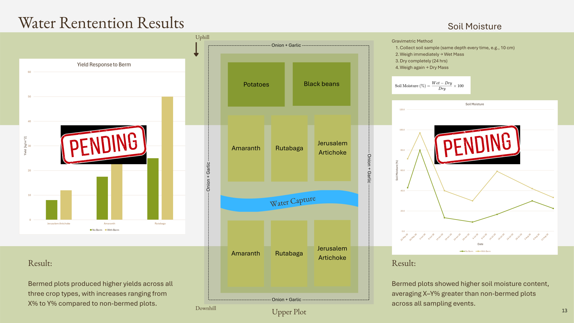
Because the site is sloped, rainfall can move downhill as runoff rather than remaining available to crops.
Aster 2.0 incorporates a contour-based berm into the upper plot to test whether a simple, passive
intervention can retain more of that water within the soil.
By comparing bermed and non-bermed areas, I can measure differences in soil moisture and eventual crop
performance. The experiment asks whether the landscape can be redesigned to make better use of a resource
already moving through it, without pumps, electricity, or mechanical infrastructure.
🔍
Measurement
Measuring Performance
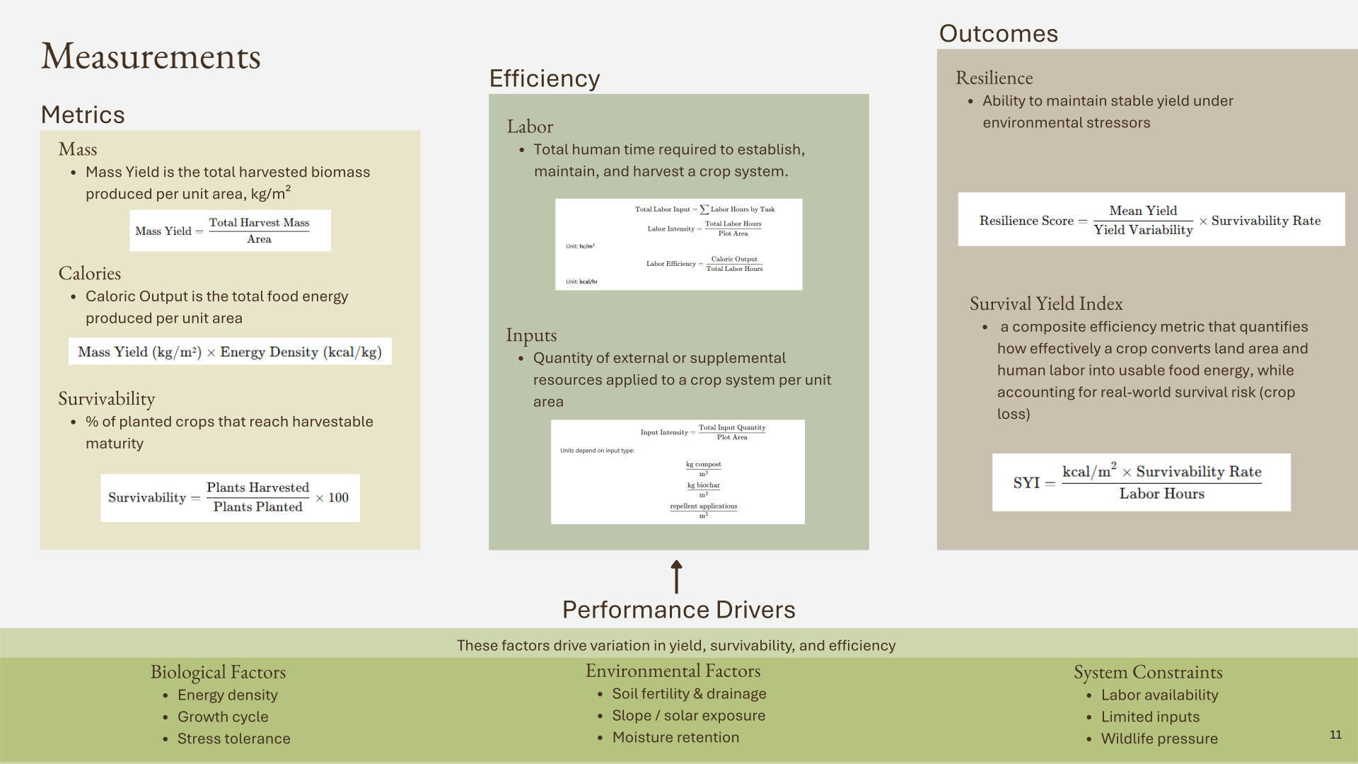
A successful harvest does not necessarily mean a successful system. A crop that produces substantial food
but requires excessive labor or outside resources may perform poorly under Aster's constraints.
For that reason, I am measuring mass yield, caloric output, survivability, labor, and resilience rather
than yield alone. Together, these measurements allow me to evaluate how effectively each crop and treatment
converts limited land and human labor into usable food energy while accounting for real-world crop loss.
🔍
Results — In Progress
Data Collection in Progress
The 2026 growing cycle and analysis are still in progress. As final measurements are collected, I am
comparing performance across the upper and lower plots, control and amended soils, and bermed and non-bermed
growing areas.
The final analysis will examine how terrain relates to yield, whether passive water capture changes soil
moisture and crop performance, how natural fertilizer and biochar affect the system, and how much usable
food is produced relative to the human labor required. Results will continue to be added as the 2026 harvest
and analysis are completed.
Aster began with one hillside and a question about whether I could produce food there without
relying on the systems I normally take for granted. The next stage is about determining how far what I learn
from this site can extend beyond it.
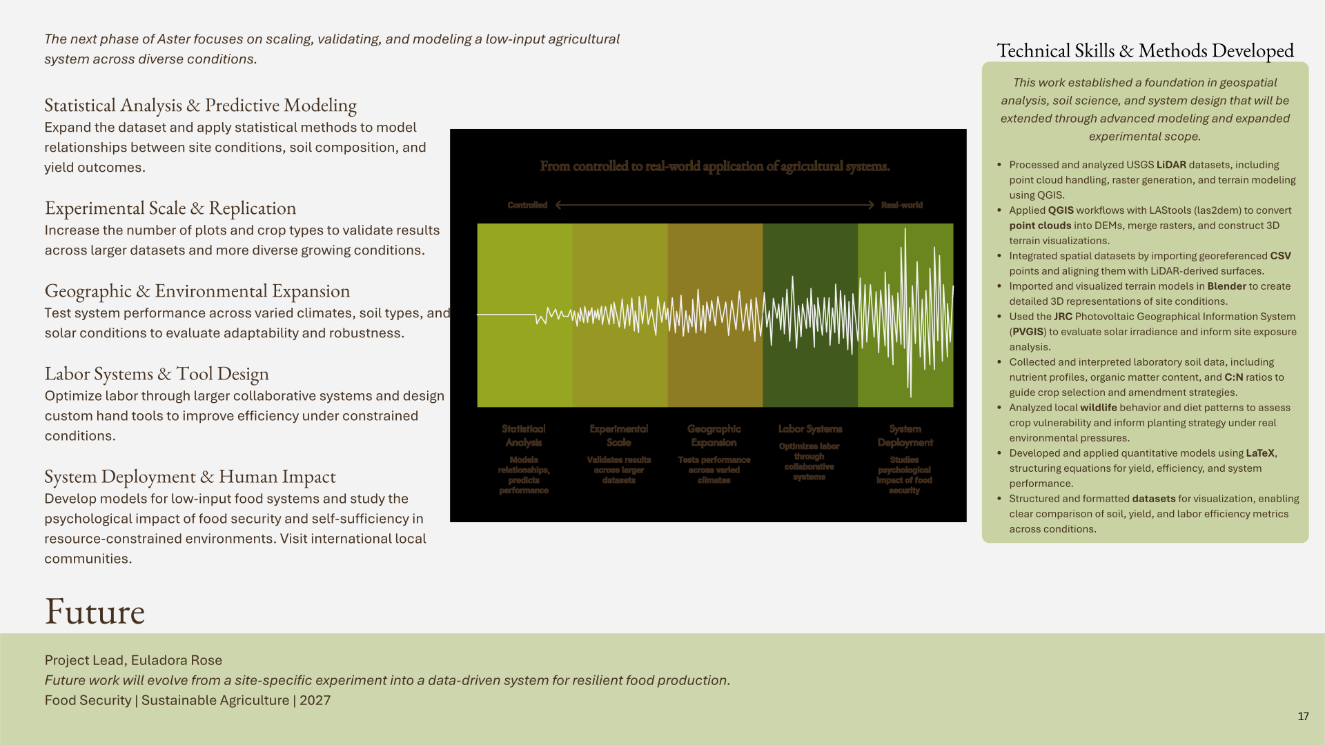
Future work will expand the dataset, introduce statistical modeling, increase experimental
replication, and eventually test the system across different environmental conditions. I also want to continue
exploring labor as a design problem through more efficient hand tools and collaborative systems.
The long-term goal is to move Aster from a site-specific experiment toward a broader model for
resilient, low-input food production: what works, where it works, how much human effort it requires, and what
happens when resources become limited.